 vesseltracker.com
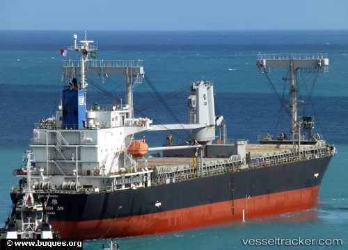
Vessel Skyhigh Sw IMO: 9606663, MMSI: 352828000 General Cargo Ship
UTC, -5.55823, 41.96518, course: 65, speed: 10.5
UTC, -5.51943, 42.00410, course: 81, speed: 0.9
2026-02-24 11:42:09 UTC, -5.50192, 41.99580, course: 113, speed: 0.5
Live AIS position:
UTC. 163 nm SE of Mombasa),
updated 2026-02-24 11:42:09 UTC.
Find the position of the vessel Skyhigh Sw on the map. The latter are known coordinates and path.
marine traffic ship tracker show on live map
The current position of vessel Skyhigh Sw is -5.50192 lat / 41.99580 lng. Updated: 2026-02-24 11:42:09 UTCDetails:
Last coordinates of the vessel:
UTC, -5.70401, 41.63795, course: 67, speed: 12UTC, -5.55823, 41.96518, course: 65, speed: 10.5
UTC, -5.51943, 42.00410, course: 81, speed: 0.9
2026-02-24 11:42:09 UTC, -5.50192, 41.99580, course: 113, speed: 0.5