 vesseltracker.com
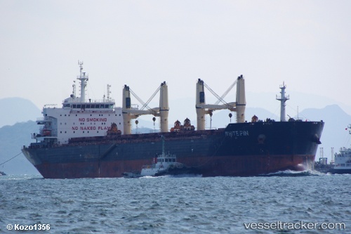
Vessel White Fin IMO: 9607291, MMSI: 256608000 Bulk Carrier
UTC, 34.14318, 132.96776, course: 308, speed: 9.9
UTC, 33.95188, 132.69209, course: 234, speed: 13
2026-02-15 15:28:18 UTC, 33.65137, 132.30782, course: 228, speed: 12.5
Live AIS position:
UTC. 10 nm N of IKATA),
updated 2026-02-15 15:28:18 UTC.
Find the position of the vessel White Fin on the map. The latter are known coordinates and path.
marine traffic ship tracker show on live map
The current position of vessel White Fin is 33.65137 lat / 132.30782 lng. Updated: 2026-02-15 15:28:18 UTCDetails:
Last coordinates of the vessel:
UTC, 34.13042, 133.13860, course: 237, speed: 9.6UTC, 34.14318, 132.96776, course: 308, speed: 9.9
UTC, 33.95188, 132.69209, course: 234, speed: 13
2026-02-15 15:28:18 UTC, 33.65137, 132.30782, course: 228, speed: 12.5