 vesseltracker.com
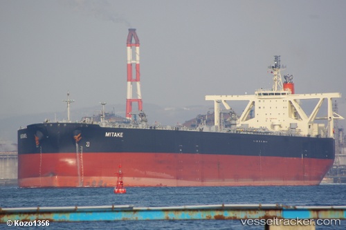
Vessel Mitake IMO: 9607863, MMSI: 373768000 Crude Oil Tanker
UTC, 29.95841, 134.86887, course: 241, speed: 14.2
UTC, 29.59189, 134.10225, course: 241, speed: 14.5
2026-02-09 16:17:11 UTC, 29.30692, 133.52689, course: 240, speed: 15.3
Live AIS position:
UTC. 157 nm SE of NISHINOOMOTE),
updated 2026-02-09 16:17:11 UTC.
Find the position of the vessel Mitake on the map. The latter are known coordinates and path.
marine traffic ship tracker show on live map
The current position of vessel Mitake is 29.30692 lat / 133.52689 lng. Updated: 2026-02-09 16:17:11 UTCDetails:
Last coordinates of the vessel:
UTC, 30.47516, 135.94118, course: 244, speed: 14.7UTC, 29.95841, 134.86887, course: 241, speed: 14.2
UTC, 29.59189, 134.10225, course: 241, speed: 14.5
2026-02-09 16:17:11 UTC, 29.30692, 133.52689, course: 240, speed: 15.3