 vesseltracker.com
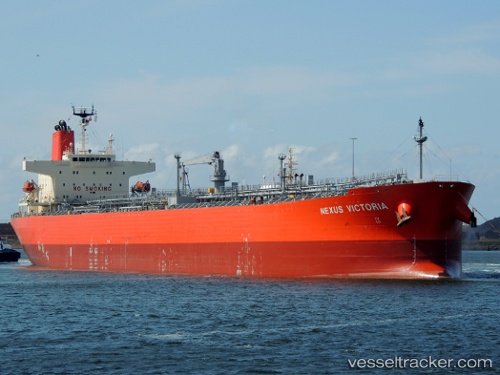
Vessel Nexus Victoria IMO: 9610389, MMSI: 235108514 Oil Products Tanker
UTC, 13.81120, 70.90732, course: 130, speed: 11.7
UTC, 13.81120, 70.90732, course: 130, speed: 11.7
2026-01-18 18:09:31 UTC, 13.55391, 71.17333, course: 132, speed: 12.3
Live AIS position:
UTC. 173 nm NW of Amini Island),
updated 2026-01-18 18:09:31 UTC.
Find the position of the vessel Nexus Victoria on the map. The latter are known coordinates and path.
marine traffic ship tracker show on live map
The current position of vessel Nexus Victoria is 13.55391 lat / 71.17333 lng. Updated: 2026-01-18 18:09:31 UTCCurrently sailing under the flag of United Kingdom
Details:
Last coordinates of the vessel:
UTC, 14.06067, 70.61866, course: 130, speed: 11.6UTC, 13.81120, 70.90732, course: 130, speed: 11.7
UTC, 13.81120, 70.90732, course: 130, speed: 11.7
2026-01-18 18:09:31 UTC, 13.55391, 71.17333, course: 132, speed: 12.3