 vesseltracker.com
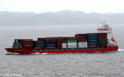
Vessel Tallahassee IMO: 9611046, MMSI: 563004500 Container Ship
UTC, 16.03085, -88.15295, course: 244, speed: 0.4
UTC, 16.00922, -88.13674, course: 187, speed: 0.5
2026-01-31 18:03:57 UTC, 15.99833, -88.11666, course: -1, speed: 0
Live AIS position:
UTC. 14 nm NW of Puerto Cortes),
updated 2026-01-31 18:03:57 UTC.
Find the position of the vessel Tallahassee on the map. The latter are known coordinates and path.
marine traffic ship tracker show on live map
The current position of vessel Tallahassee is 15.99833 lat / -88.11666 lng. Updated: 2026-01-31 18:03:57 UTCDetails:
Last coordinates of the vessel:
UTC, 16.02167, -88.15667, course: -1, speed: 0UTC, 16.03085, -88.15295, course: 244, speed: 0.4
UTC, 16.00922, -88.13674, course: 187, speed: 0.5
2026-01-31 18:03:57 UTC, 15.99833, -88.11666, course: -1, speed: 0