 vesseltracker.com
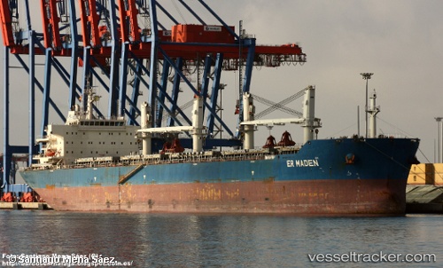
Vessel ER MADEN IMO: 9611993, MMSI: 538009100 Bulk Carrier
UTC, 31.75396, 31.98319, course: 36, speed: 12.2
UTC, 32.19333, 32.33167, course: -1, speed: 11
2026-02-25 09:22:11 UTC, 32.43667, 32.52333, course: -1, speed: 12
Live AIS position:
UTC. 32 nm NW of Atakka Dry Port),
updated 2026-02-25 09:22:11 UTC.
Find the position of the vessel ER MADEN on the map. The latter are known coordinates and path.
marine traffic ship tracker show on live map
The current position of vessel ER MADEN is 32.43667 lat / 32.52333 lng. Updated: 2026-02-25 09:22:11 UTCCurrently sailing under the flag of Marshall Islands
ER MADEN built in 2012 year
Deadweight:
56522 tDetails:
Last coordinates of the vessel:
UTC, 31.52972, 31.76882, course: 9, speed: 11.4UTC, 31.75396, 31.98319, course: 36, speed: 12.2
UTC, 32.19333, 32.33167, course: -1, speed: 11
2026-02-25 09:22:11 UTC, 32.43667, 32.52333, course: -1, speed: 12