 vesseltracker.com
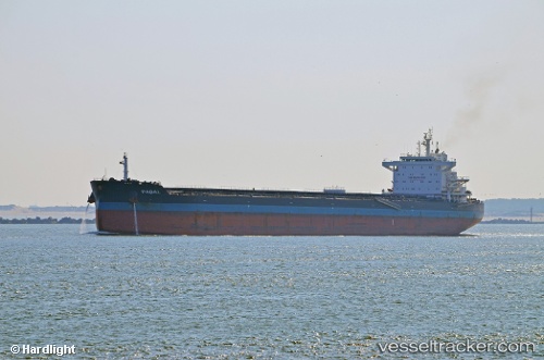
Vessel Pabal IMO: 9614842, MMSI: 305843000 Bulk Carrier
UTC, 54.53654, -167.58183, course: 272, speed: 8
UTC, 54.56854, -168.08421, course: 275, speed: 8.9
2026-02-14 16:20:42 UTC, 54.60012, -168.68887, course: 273, speed: 10
Live AIS position:
UTC. 88 nm NW of Dutch Harbor),
updated 2026-02-14 16:20:42 UTC.
Find the position of the vessel Pabal on the map. The latter are known coordinates and path.
marine traffic ship tracker show on live map
The current position of vessel Pabal is 54.60012 lat / -168.68887 lng. Updated: 2026-02-14 16:20:42 UTCCurrently sailing under the flag of Antigua Barbuda
Pabal built in 2012 year
Deadweight:
75378 tDetails:
Last coordinates of the vessel:
UTC, 54.50075, -167.02177, course: 274, speed: 7.6UTC, 54.53654, -167.58183, course: 272, speed: 8
UTC, 54.56854, -168.08421, course: 275, speed: 8.9
2026-02-14 16:20:42 UTC, 54.60012, -168.68887, course: 273, speed: 10