 vesseltracker.com
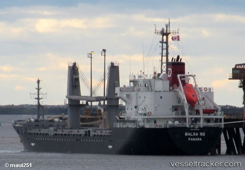
Vessel Balsa 92 IMO: 9616060, MMSI: 370350000 General Cargo Ship
UTC, 15.96453, -88.00782, course: 320, speed: 0.9
UTC, 15.93675, -87.97232, course: 323, speed: 0.7
2026-02-07 14:03:17 UTC, 15.84259, -87.95525, course: 278, speed: 0
Live AIS position:
UTC. Near Puerto Cortes),
updated 2026-02-07 14:03:17 UTC.
Find the position of the vessel Balsa 92 on the map. The latter are known coordinates and path.
marine traffic ship tracker show on live map
The current position of vessel Balsa 92 is 15.84259 lat / -87.95525 lng. Updated: 2026-02-07 14:03:17 UTCCurrently sailing under the flag of Panama
Balsa 92 built in 2013 year
Deadweight:
7733 tDetails:
Last coordinates of the vessel:
UTC, 15.95656, -88.02629, course: 154, speed: 6UTC, 15.96453, -88.00782, course: 320, speed: 0.9
UTC, 15.93675, -87.97232, course: 323, speed: 0.7
2026-02-07 14:03:17 UTC, 15.84259, -87.95525, course: 278, speed: 0