 vesseltracker.com
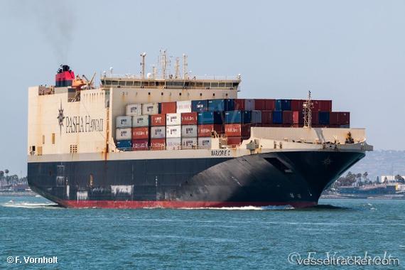
Vessel Marjorie C. IMO: 9619684, MMSI: 367641230 Ro Ro Cargo Ship
UTC, 22.07497, -154.27661, course: 67, speed: 20.1
UTC, 22.27528, -153.82407, course: 67, speed: 19.9
2026-03-05 04:20:02 UTC, 22.68740, -152.88800, course: 68, speed: 20.1
Live Vessel Marjorie C. Analytics (details, animations, etc.)
Live AIS position: UTC. 216 nm NE of Hilo), updated 2026-03-05 04:20:02 UTC.Find the position of the vessel Marjorie C. on the map. The latter are known coordinates and path.
marine traffic ship tracker show on live map
The current position of vessel Marjorie C. is 22.68740 lat / -152.88800 lng. Updated: 2026-03-05 04:20:02 UTCDetails:
Last coordinates of the vessel:
UTC, 20.89814, -156.46878, course: 302, speed: 0UTC, 22.07497, -154.27661, course: 67, speed: 20.1
UTC, 22.27528, -153.82407, course: 67, speed: 19.9
2026-03-05 04:20:02 UTC, 22.68740, -152.88800, course: 68, speed: 20.1