 vesseltracker.com
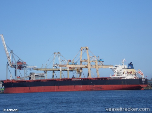
Vessel Ju Hua Hai IMO: 9620528, MMSI: 412533000 Bulk Carrier
UTC, -4.25788, 117.99278, course: 28, speed: 11.3
UTC, -4.11280, 118.07519, course: 32, speed: 11.5
2026-02-13 20:32:51 UTC, -4.11280, 118.07519, course: 32, speed: 11.5
Live AIS position:
UTC. 93 nm W of PARE PARE),
updated 2026-02-13 20:32:51 UTC.
Find the position of the vessel Ju Hua Hai on the map. The latter are known coordinates and path.
marine traffic ship tracker show on live map
The current position of vessel Ju Hua Hai is -4.11280 lat / 118.07519 lng. Updated: 2026-02-13 20:32:51 UTCCurrently sailing under the flag of China
Ju Hua Hai built in 2012 year
Deadweight:
115075 tDetails:
Last coordinates of the vessel:
UTC, -4.55699, 117.79427, course: 34, speed: 11.4UTC, -4.25788, 117.99278, course: 28, speed: 11.3
UTC, -4.11280, 118.07519, course: 32, speed: 11.5
2026-02-13 20:32:51 UTC, -4.11280, 118.07519, course: 32, speed: 11.5