 vesseltracker.com
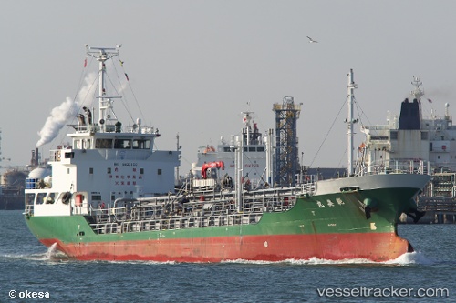
Vessel Noriyoshimaru IMO: 9622100, MMSI: 431003089 Chemical Tanker
UTC, 34.98585, 139.38071, course: 243, speed: 10.3
UTC, 34.77350, 139.10805, course: 214, speed: 10.3
2026-02-13 12:03:55 UTC, 34.59312, 138.78098, course: 275, speed: 9.6
Live AIS position:
UTC. Near Iruma),
updated 2026-02-13 12:03:55 UTC.
Find the position of the vessel Noriyoshimaru on the map. The latter are known coordinates and path.
marine traffic ship tracker show on live map
The current position of vessel Noriyoshimaru is 34.59312 lat / 138.78098 lng. Updated: 2026-02-13 12:03:55 UTCCurrently sailing under the flag of Japan
Details:
Last coordinates of the vessel:
UTC, 35.14832, 139.72096, course: 212, speed: 10.7UTC, 34.98585, 139.38071, course: 243, speed: 10.3
UTC, 34.77350, 139.10805, course: 214, speed: 10.3
2026-02-13 12:03:55 UTC, 34.59312, 138.78098, course: 275, speed: 9.6