 vesseltracker.com
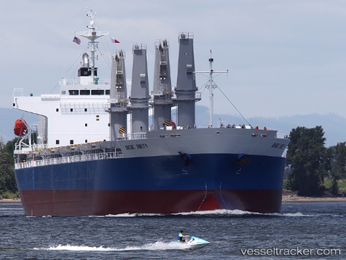
Vessel Ac Amity IMO: 9623116, MMSI: 351187000 General Cargo Ship
UTC, -13.32346, 107.63602, course: 339, speed: 12.4
UTC, -12.92167, 107.46667, course: -1, speed: 12
2026-02-15 05:45:29 UTC, -12.66284, 107.35330, course: 338, speed: 12.4
Live AIS position:
UTC. 166 nm SE of Flying Fish Cove),
updated 2026-02-15 05:45:29 UTC.
Find the position of the vessel Ac Amity on the map. The latter are known coordinates and path.
marine traffic ship tracker show on live map
The current position of vessel Ac Amity is -12.66284 lat / 107.35330 lng. Updated: 2026-02-15 05:45:29 UTCDetails:
Last coordinates of the vessel:
UTC, -13.85500, 107.84833, course: -1, speed: 12UTC, -13.32346, 107.63602, course: 339, speed: 12.4
UTC, -12.92167, 107.46667, course: -1, speed: 12
2026-02-15 05:45:29 UTC, -12.66284, 107.35330, course: 338, speed: 12.4