 vesseltracker.com
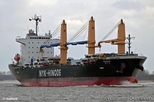
Vessel Isuzu IMO: 9624902, MMSI: 371884000 Multi Purpose Carrier
UTC, -22.81209, 51.54131, course: 57, speed: 11.4
UTC, -22.60369, 51.88581, course: 56, speed: 11.6
2026-01-31 17:21:51 UTC, -22.41067, 52.20217, course: 58, speed: 11.6
Live AIS position:
UTC. 188 nm SW of Saint-Gilles),
updated 2026-01-31 17:21:51 UTC.
Find the position of the vessel Isuzu on the map. The latter are known coordinates and path.
marine traffic ship tracker show on live map
The current position of vessel Isuzu is -22.41067 lat / 52.20217 lng. Updated: 2026-01-31 17:21:51 UTCCurrently sailing under the flag of Panama
Isuzu built in 2013 year
Deadweight:
20352 tDetails:
Last coordinates of the vessel:
UTC, -22.94146, 51.32185, course: 57, speed: 11.5UTC, -22.81209, 51.54131, course: 57, speed: 11.4
UTC, -22.60369, 51.88581, course: 56, speed: 11.6
2026-01-31 17:21:51 UTC, -22.41067, 52.20217, course: 58, speed: 11.6