 vesseltracker.com
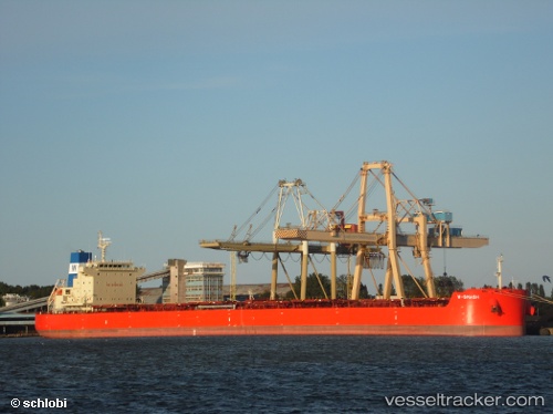
Vessel W Smash IMO: 9625877, MMSI: 636016053 Bulk Carrier
UTC, 46.20890, -123.80201, course: 67, speed: 0.1
UTC, 46.20916, -123.80234, course: 80, speed: 0.1
2026-02-15 01:29:34 UTC, 46.20891, -123.80209, course: 61, speed: 0.2
Live AIS position:
UTC. Near Astoria),
updated 2026-02-15 01:29:34 UTC.
Find the position of the vessel W Smash on the map. The latter are known coordinates and path.
marine traffic ship tracker show on live map
The current position of vessel W Smash is 46.20891 lat / -123.80209 lng. Updated: 2026-02-15 01:29:34 UTCDetails:
Last coordinates of the vessel:
UTC, 46.20889, -123.80200, course: 66, speed: 0.2UTC, 46.20890, -123.80201, course: 67, speed: 0.1
UTC, 46.20916, -123.80234, course: 80, speed: 0.1
2026-02-15 01:29:34 UTC, 46.20891, -123.80209, course: 61, speed: 0.2