 vesseltracker.com
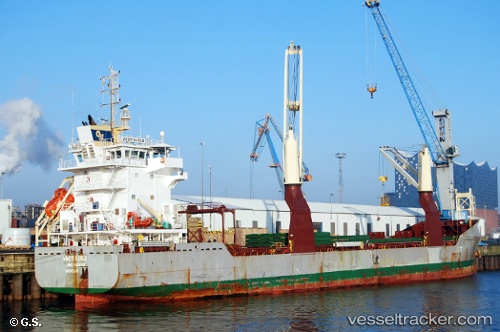
Vessel Vectis Isle IMO: 9626156, MMSI: 235095836 Multi Purpose Carrier
UTC, 43.94167, -5.35500, course: -1, speed: 9
UTC, 43.99339, -5.77315, course: 280, speed: 8.4
2026-02-09 11:32:54 UTC, 44.01833, -6.05500, course: -1, speed: 8
Live AIS position:
UTC. Near Llanera),
updated 2026-02-09 11:32:54 UTC.
Find the position of the vessel Vectis Isle on the map. The latter are known coordinates and path.
marine traffic ship tracker show on live map
The current position of vessel Vectis Isle is 44.01833 lat / -6.05500 lng. Updated: 2026-02-09 11:32:54 UTCCurrently sailing under the flag of United Kingdom
Vectis Isle built in 2012 year
Deadweight:
10199 tDetails:
Last coordinates of the vessel:
UTC, 43.90333, -5.04833, course: -1, speed: 9UTC, 43.94167, -5.35500, course: -1, speed: 9
UTC, 43.99339, -5.77315, course: 280, speed: 8.4
2026-02-09 11:32:54 UTC, 44.01833, -6.05500, course: -1, speed: 8