 vesseltracker.com
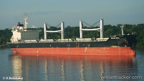
Vessel LIMA STRAIT IMO: 9626364, MMSI: 636093065 Bulk Carrier
UTC, -32.86833, 28.92167, course: -1, speed: 13
UTC, -32.98427, 28.76045, course: 227, speed: 13.6
2026-02-26 09:30:24 UTC, -33.33965, 28.23262, course: 228, speed: 14
Live AIS position:
UTC. 25 nm SE of West Bank),
updated 2026-02-26 09:30:24 UTC.
Find the position of the vessel LIMA STRAIT on the map. The latter are known coordinates and path.
marine traffic ship tracker show on live map
The current position of vessel LIMA STRAIT is -33.33965 lat / 28.23262 lng. Updated: 2026-02-26 09:30:24 UTCCurrently sailing under the flag of Liberia
LIMA STRAIT built in 2012 year
Deadweight:
37187 tDetails:
Last coordinates of the vessel:
UTC, -32.59333, 29.29333, course: -1, speed: 13UTC, -32.86833, 28.92167, course: -1, speed: 13
UTC, -32.98427, 28.76045, course: 227, speed: 13.6
2026-02-26 09:30:24 UTC, -33.33965, 28.23262, course: 228, speed: 14