 vesseltracker.com
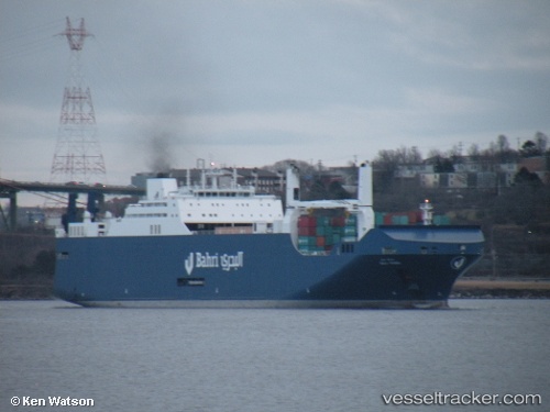
Vessel Bahri Yanbu IMO: 9626534, MMSI: 403532001 Ro Ro Cargo Ship
UTC, 20.14347, 115.99818, course: 208, speed: 14.9
UTC, 19.83497, 115.82320, course: 208, speed: 15.1
2026-02-14 13:54:51 UTC, 19.34688, 115.54740, course: 200, speed: 15.2
Live AIS position:
UTC. 122 nm S of Xijiang),
updated 2026-02-14 13:54:51 UTC.
Find the position of the vessel Bahri Yanbu on the map. The latter are known coordinates and path.
marine traffic ship tracker show on live map
The current position of vessel Bahri Yanbu is 19.34688 lat / 115.54740 lng. Updated: 2026-02-14 13:54:51 UTCCurrently sailing under the flag of Saudi Arabia
Details:
Last coordinates of the vessel:
UTC, 20.77380, 116.35140, course: 207, speed: 15.3UTC, 20.14347, 115.99818, course: 208, speed: 14.9
UTC, 19.83497, 115.82320, course: 208, speed: 15.1
2026-02-14 13:54:51 UTC, 19.34688, 115.54740, course: 200, speed: 15.2