 vesseltracker.com
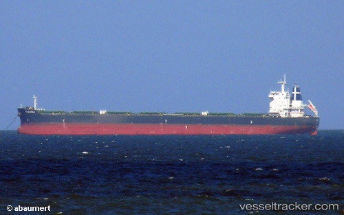
Vessel Panorea IMO: 9628104, MMSI: 229027000 Bulk Carrier
UTC, 40.93927, 28.85618, course: 233, speed: 0
UTC, 40.93746, 28.85535, course: 286, speed: 0
2026-01-29 13:55:47 UTC, 40.93819, 28.85560, course: 249, speed: 0
Live AIS position:
UTC. Near Kumport),
updated 2026-01-29 13:55:47 UTC.
Find the position of the vessel Panorea on the map. The latter are known coordinates and path.
marine traffic ship tracker show on live map
The current position of vessel Panorea is 40.93819 lat / 28.85560 lng. Updated: 2026-01-29 13:55:47 UTCDetails:
Last coordinates of the vessel:
UTC, 40.93934, 28.85608, course: 233, speed: 0UTC, 40.93927, 28.85618, course: 233, speed: 0
UTC, 40.93746, 28.85535, course: 286, speed: 0
2026-01-29 13:55:47 UTC, 40.93819, 28.85560, course: 249, speed: 0