 vesseltracker.com
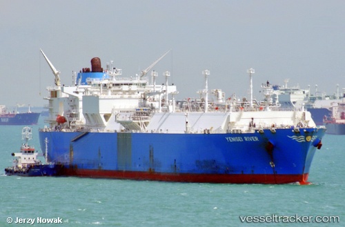
Vessel Yenisei River IMO: 9629586, MMSI: 538005072 Lng Tanker
UTC, 29.40167, -14.36833, course: -1, speed: 5
UTC, 29.50446, -14.24287, course: 43, speed: 6.3
2026-02-15 23:49:56 UTC, 29.69879, -14.03219, course: 46, speed: 6.6
Live AIS position:
UTC. 39 nm NW of Caleta de Sebo),
updated 2026-02-15 23:49:56 UTC.
Find the position of the vessel Yenisei River on the map. The latter are known coordinates and path.
marine traffic ship tracker show on live map
The current position of vessel Yenisei River is 29.69879 lat / -14.03219 lng. Updated: 2026-02-15 23:49:56 UTCCurrently sailing under the flag of Marshall Is
Yenisei River built in 2013 year
Deadweight:
84604 tDetails:
Last coordinates of the vessel:
UTC, 29.28897, -14.49481, course: 45, speed: 5.7UTC, 29.40167, -14.36833, course: -1, speed: 5
UTC, 29.50446, -14.24287, course: 43, speed: 6.3
2026-02-15 23:49:56 UTC, 29.69879, -14.03219, course: 46, speed: 6.6