 vesseltracker.com
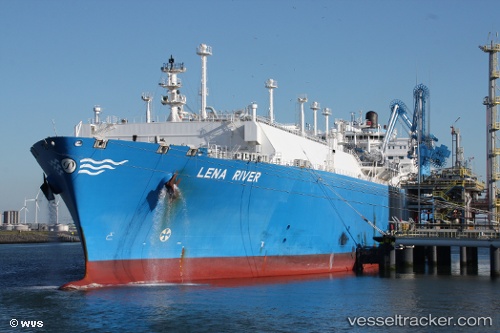
Vessel Lena River IMO: 9629598, MMSI: 538005073 Lng Tanker
UTC, -34.66436, 31.02733, course: 258, speed: 5.7
UTC, -34.70638, 30.78324, course: 256, speed: 5.6
2026-02-27 06:00:50 UTC, -34.75738, 30.49611, course: 257, speed: 5.4
Live AIS position:
UTC. 165 nm SE of Gonubie),
updated 2026-02-27 06:00:50 UTC.
Find the position of the vessel Lena River on the map. The latter are known coordinates and path.
marine traffic ship tracker show on live map
The current position of vessel Lena River is -34.75738 lat / 30.49611 lng. Updated: 2026-02-27 06:00:50 UTCDetails:
Last coordinates of the vessel:
UTC, -34.63242, 31.20757, course: 256, speed: 6.1UTC, -34.66436, 31.02733, course: 258, speed: 5.7
UTC, -34.70638, 30.78324, course: 256, speed: 5.6
2026-02-27 06:00:50 UTC, -34.75738, 30.49611, course: 257, speed: 5.4