 vesseltracker.com
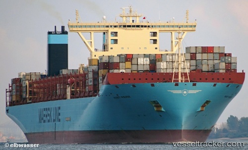
Vessel Marit Maersk IMO: 9632167, MMSI: 219632000 Container Ship
UTC, 16.08067, 116.68523, course: -1, speed: 19.2
UTC, 16.55857, 117.04467, course: -1, speed: 19
2026-03-05 01:40:50 UTC, 17.08223, 117.41610, course: -1, speed: 19.2
Live Vessel Marit Maersk Analytics (details, animations, etc.)
Live AIS position: UTC. 148 nm W of Bolinao), updated 2026-03-05 01:40:50 UTC.Find the position of the vessel Marit Maersk on the map. The latter are known coordinates and path.
marine traffic ship tracker show on live map
The current position of vessel Marit Maersk is 17.08223 lat / 117.41610 lng. Updated: 2026-03-05 01:40:50 UTCDetails:
Last coordinates of the vessel:
UTC, 15.55510, 116.27347, course: -1, speed: 19.5UTC, 16.08067, 116.68523, course: -1, speed: 19.2
UTC, 16.55857, 117.04467, course: -1, speed: 19
2026-03-05 01:40:50 UTC, 17.08223, 117.41610, course: -1, speed: 19.2