 vesseltracker.com
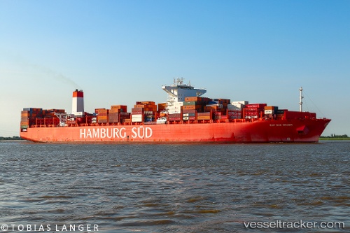
Vessel Cap San Sounio IMO: 9633953, MMSI: 372723000 Container Ship
UTC, 52.06920, 2.45973, course: 256, speed: 0.2
UTC, 52.10981, 2.48910, course: 228, speed: 1.9
2026-02-08 18:03:18 UTC, 51.98980, 2.33553, course: 220, speed: 7.9
Live AIS position:
UTC. 24 nm NE of Krieschow),
updated 2026-02-08 18:03:18 UTC.
Find the position of the vessel Cap San Sounio on the map. The latter are known coordinates and path.
marine traffic ship tracker show on live map
The current position of vessel Cap San Sounio is 51.98980 lat / 2.33553 lng. Updated: 2026-02-08 18:03:18 UTCCurrently sailing under the flag of Panama
Details:
Last coordinates of the vessel:
UTC, 52.07638, 2.46410, course: 269, speed: 0.4UTC, 52.06920, 2.45973, course: 256, speed: 0.2
UTC, 52.10981, 2.48910, course: 228, speed: 1.9
2026-02-08 18:03:18 UTC, 51.98980, 2.33553, course: 220, speed: 7.9