 vesseltracker.com
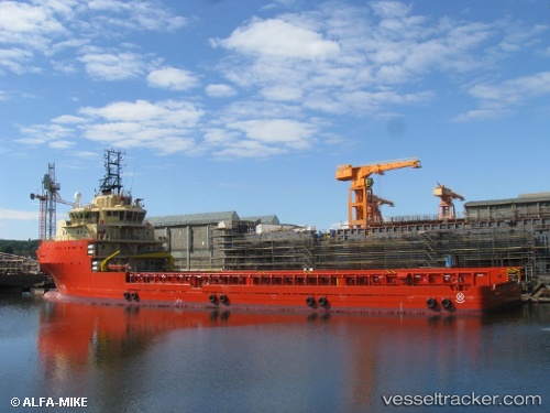
Vessel ORYX IMO: 9636034, MMSI: 710005142 Offshore Supply Ship
UTC, -23.85500, -42.73333, course: -1, speed: 7
UTC, -24.11667, -42.63333, course: -1, speed: 7
2026-02-05 20:09:19 UTC, -24.31928, -42.54714, course: 160, speed: 7.9
Live AIS position:
UTC. 75 nm N of Cidade de Angra dos Reis FPSO),
updated 2026-02-05 20:09:19 UTC.
Find the position of the vessel ORYX on the map. The latter are known coordinates and path.
marine traffic ship tracker show on live map
The current position of vessel ORYX is -24.31928 lat / -42.54714 lng. Updated: 2026-02-05 20:09:19 UTCCurrently sailing under the flag of Brazil
ORYX built in 2013 year
Deadweight:
5492 tDetails:
Last coordinates of the vessel:
UTC, -23.55478, -42.88263, course: 156, speed: 8UTC, -23.85500, -42.73333, course: -1, speed: 7
UTC, -24.11667, -42.63333, course: -1, speed: 7
2026-02-05 20:09:19 UTC, -24.31928, -42.54714, course: 160, speed: 7.9