 vesseltracker.com
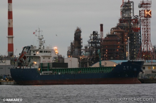
Vessel DE MI IMO: 9643752, MMSI: 668116254 Cargo
UTC, 34.28582, 134.98766, course: -1, speed: 8.3
UTC, 34.61167, 135.03500, course: -1, speed: 9
2026-02-26 15:14:32 UTC, 34.59500, 134.89833, course: -1, speed: 11
Live AIS position:
UTC. Near AKASHI),
updated 2026-02-26 15:14:32 UTC.
Find the position of the vessel DE MI on the map. The latter are known coordinates and path.
marine traffic ship tracker show on live map
The current position of vessel DE MI is 34.59500 lat / 134.89833 lng. Updated: 2026-02-26 15:14:32 UTCCurrently sailing under the flag of Sao Tome and Principe
Details:
Last coordinates of the vessel:
UTC, 33.84833, 135.00833, course: -1, speed: 9UTC, 34.28582, 134.98766, course: -1, speed: 8.3
UTC, 34.61167, 135.03500, course: -1, speed: 9
2026-02-26 15:14:32 UTC, 34.59500, 134.89833, course: -1, speed: 11