 vesseltracker.com
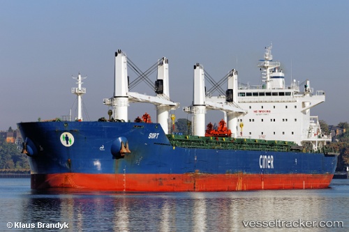
Vessel Siirt IMO: 9644196, MMSI: 229221000 Bulk Carrier
UTC, 36.23602, -5.02303, course: 295, speed: 0.5
UTC, 36.23224, -5.05119, course: 332, speed: 0.6
2026-02-24 06:19:22 UTC, 36.24854, -5.02792, course: 84, speed: 1.7
Live AIS position:
UTC. 12 nm SE of San Luis de Sabinillas),
updated 2026-02-24 06:19:22 UTC.
Find the position of the vessel Siirt on the map. The latter are known coordinates and path.
marine traffic ship tracker show on live map
The current position of vessel Siirt is 36.24854 lat / -5.02792 lng. Updated: 2026-02-24 06:19:22 UTCCurrently sailing under the flag of Malta
Siirt built in 2013 year
Deadweight:
63500 tDetails:
Last coordinates of the vessel:
UTC, 36.24506, -5.00414, course: 351, speed: 0.1UTC, 36.23602, -5.02303, course: 295, speed: 0.5
UTC, 36.23224, -5.05119, course: 332, speed: 0.6
2026-02-24 06:19:22 UTC, 36.24854, -5.02792, course: 84, speed: 1.7