 vesseltracker.com
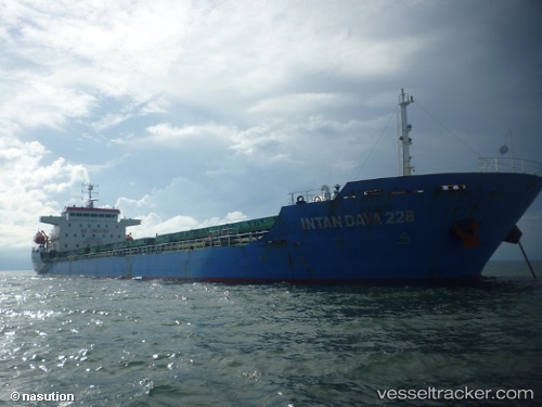
Vessel Intan Daya 228 IMO: 9646948, MMSI: 525003201 General Cargo Ship
UTC, 1.18852, 103.66443, course: 307, speed: 4.5
UTC, 1.28175, 103.66270, course: 143, speed: 1.1
2026-02-04 03:50:37 UTC, 1.27806, 103.66613, course: 233, speed: 0
Live AIS position:
UTC. Near JURONG ISLAND),
updated 2026-02-04 03:50:37 UTC.
Find the position of the vessel Intan Daya 228 on the map. The latter are known coordinates and path.
marine traffic ship tracker show on live map
The current position of vessel Intan Daya 228 is 1.27806 lat / 103.66613 lng. Updated: 2026-02-04 03:50:37 UTCCurrently sailing under the flag of Indonesia
Intan Daya 228 built in 2012 year
Deadweight:
12000 tDetails:
Last coordinates of the vessel:
UTC, 1.20741, 103.91011, course: 296, speed: 8.3UTC, 1.18852, 103.66443, course: 307, speed: 4.5
UTC, 1.28175, 103.66270, course: 143, speed: 1.1
2026-02-04 03:50:37 UTC, 1.27806, 103.66613, course: 233, speed: 0