 vesseltracker.com
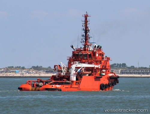
Vessel SEAWAYS 22 IMO: 9647954, MMSI: 375147000 Anchor Handling Vessel
UTC, 8.00667, -56.99333, course: -1, speed: 2
UTC, 8.00667, -56.99167, course: -1, speed: 0
2026-02-26 23:26:03 UTC, 8.00722, -56.99140, course: 69, speed: 0.6
Live AIS position:
UTC. 95 nm NE of Enmore),
updated 2026-02-26 23:26:03 UTC.
Find the position of the vessel SEAWAYS 22 on the map. The latter are known coordinates and path.
marine traffic ship tracker show on live map
The current position of vessel SEAWAYS 22 is 8.00722 lat / -56.99140 lng. Updated: 2026-02-26 23:26:03 UTCCurrently sailing under the flag of Saint Vincent and the Grenadines
Details:
Last coordinates of the vessel:
UTC, 8.01201, -56.99473, course: 287, speed: 1.6UTC, 8.00667, -56.99333, course: -1, speed: 2
UTC, 8.00667, -56.99167, course: -1, speed: 0
2026-02-26 23:26:03 UTC, 8.00722, -56.99140, course: 69, speed: 0.6