 vesseltracker.com
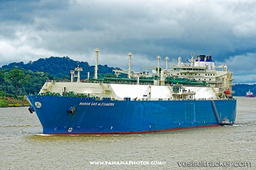
Vessel Maran Gas Alexandria IMO: 9650054, MMSI: 241353000 Lng Tanker
UTC, 26.49978, -72.59304, course: 260, speed: 18.8
UTC, 26.35853, -73.43537, course: 259, speed: 17.8
2026-02-28 22:03:44 UTC, 26.23954, -74.15453, course: 256, speed: 18.2
Live AIS position:
UTC. 128 nm NE of Arthur's Town, Cat Island),
updated 2026-02-28 22:03:44 UTC.
Find the position of the vessel Maran Gas Alexandria on the map. The latter are known coordinates and path.
marine traffic ship tracker show on live map
The current position of vessel Maran Gas Alexandria is 26.23954 lat / -74.15453 lng. Updated: 2026-02-28 22:03:44 UTCDetails:
Last coordinates of the vessel:
UTC, 26.56417, -72.19276, course: 260, speed: 18.8UTC, 26.49978, -72.59304, course: 260, speed: 18.8
UTC, 26.35853, -73.43537, course: 259, speed: 17.8
2026-02-28 22:03:44 UTC, 26.23954, -74.15453, course: 256, speed: 18.2