 vesseltracker.com
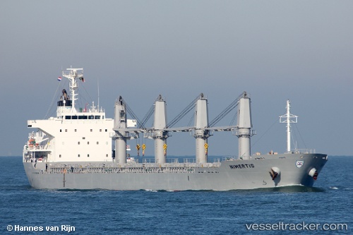
Vessel Nimertis IMO: 9650999, MMSI: 636015990 Bulk Carrier
UTC, 53.91495, 7.80005, course: 79, speed: 0.2
UTC, 53.91506, 7.80007, course: 104, speed: 0.3
2026-02-12 05:29:12 UTC, 53.91463, 7.80010, course: 72, speed: 0.4
Live AIS position:
UTC. Near Wangerooge),
updated 2026-02-12 05:29:12 UTC.
Find the position of the vessel Nimertis on the map. The latter are known coordinates and path.
marine traffic ship tracker show on live map
The current position of vessel Nimertis is 53.91463 lat / 7.80010 lng. Updated: 2026-02-12 05:29:12 UTCCurrently sailing under the flag of Liberia
Nimertis built in 2013 year
Deadweight:
28396 tDetails:
Last coordinates of the vessel:
UTC, 53.91437, 7.80020, course: 67, speed: 0.4UTC, 53.91495, 7.80005, course: 79, speed: 0.2
UTC, 53.91506, 7.80007, course: 104, speed: 0.3
2026-02-12 05:29:12 UTC, 53.91463, 7.80010, course: 72, speed: 0.4