 vesseltracker.com
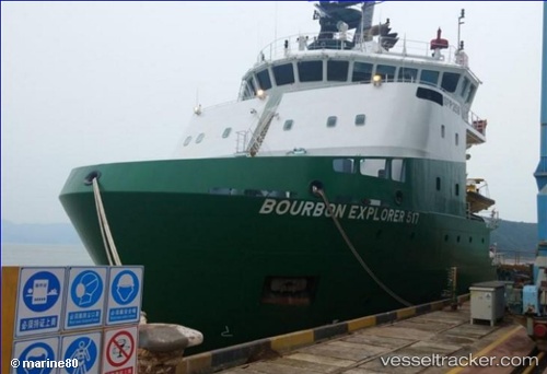
Vessel Bourbon Explorer 517 IMO: 9654323, MMSI: 228064800 Offshore Tug Supply Ship
UTC, -7.66961, 11.74016, course: 255, speed: 0.7
UTC, -7.69055, 11.75823, course: 208, speed: 2.2
2026-02-01 07:35:43 UTC, -7.68595, 11.76127, course: 200, speed: 0.3
Live AIS position:
UTC. Near Dalia),
updated 2026-02-01 07:35:43 UTC.
Find the position of the vessel Bourbon Explorer 517 on the map. The latter are known coordinates and path.
marine traffic ship tracker show on live map
The current position of vessel Bourbon Explorer 517 is -7.68595 lat / 11.76127 lng. Updated: 2026-02-01 07:35:43 UTCDetails:
Last coordinates of the vessel:
UTC, -7.67435, 11.74634, course: 301, speed: 2.4UTC, -7.66961, 11.74016, course: 255, speed: 0.7
UTC, -7.69055, 11.75823, course: 208, speed: 2.2
2026-02-01 07:35:43 UTC, -7.68595, 11.76127, course: 200, speed: 0.3