 vesseltracker.com
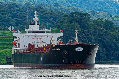
Vessel Clearocean Maria IMO: 9655975, MMSI: 636016402 Chemical Oil Products Tanker
UTC, 29.24799, -75.49703, course: 221, speed: 12.6
UTC, 28.94440, -75.80577, course: 222, speed: 13.2
2026-02-19 16:03:23 UTC, 28.60730, -76.14893, course: 227, speed: 13
Live AIS position:
UTC. 128 nm NE of Green Turtle Cay),
updated 2026-02-19 16:03:23 UTC.
Find the position of the vessel Clearocean Maria on the map. The latter are known coordinates and path.
marine traffic ship tracker show on live map
The current position of vessel Clearocean Maria is 28.60730 lat / -76.14893 lng. Updated: 2026-02-19 16:03:23 UTCCurrently sailing under the flag of Liberia
Details:
Last coordinates of the vessel:
UTC, 29.72377, -75.01270, course: 219, speed: 13.6UTC, 29.24799, -75.49703, course: 221, speed: 12.6
UTC, 28.94440, -75.80577, course: 222, speed: 13.2
2026-02-19 16:03:23 UTC, 28.60730, -76.14893, course: 227, speed: 13