 vesseltracker.com
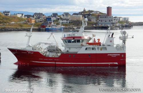
Vessel Straumberg IMO: 9656395, MMSI: 257177000 Fish Carrier
UTC, 50.17262, -6.01314, course: 180, speed: 5.1
UTC, 50.03334, -6.01111, course: 189, speed: 5.3
2026-02-27 04:19:54 UTC, 49.90653, -5.80635, course: 87, speed: 8.7
Live AIS position:
UTC. Near Porthgwarra),
updated 2026-02-27 04:19:54 UTC.
Find the position of the vessel Straumberg on the map. The latter are known coordinates and path.
marine traffic ship tracker show on live map
The current position of vessel Straumberg is 49.90653 lat / -5.80635 lng. Updated: 2026-02-27 04:19:54 UTCCurrently sailing under the flag of Norway
Straumberg built in 2014 year
Deadweight:
650 tDetails:
Last coordinates of the vessel:
UTC, 50.31162, -5.99964, course: 200, speed: 4.8UTC, 50.17262, -6.01314, course: 180, speed: 5.1
UTC, 50.03334, -6.01111, course: 189, speed: 5.3
2026-02-27 04:19:54 UTC, 49.90653, -5.80635, course: 87, speed: 8.7