 vesseltracker.com
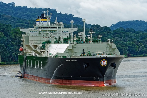
Vessel Maria Energy IMO: 9659725, MMSI: 636017445 Lng Tanker
UTC, 21.90197, 115.73108, course: 154, speed: 2.2
UTC, 21.68014, 115.59509, course: 148, speed: 2.2
2026-03-03 13:31:25 UTC, 21.61875, 115.52759, course: 154, speed: 4
Live AIS position:
UTC. 42 nm NE of Xijiang),
updated 2026-03-03 13:31:25 UTC.
Find the position of the vessel Maria Energy on the map. The latter are known coordinates and path.
marine traffic ship tracker show on live map
The current position of vessel Maria Energy is 21.61875 lat / 115.52759 lng. Updated: 2026-03-03 13:31:25 UTCDetails:
Last coordinates of the vessel:
UTC, 21.90197, 115.73108, course: 154, speed: 2.2UTC, 21.90197, 115.73108, course: 154, speed: 2.2
UTC, 21.68014, 115.59509, course: 148, speed: 2.2
2026-03-03 13:31:25 UTC, 21.61875, 115.52759, course: 154, speed: 4