 vesseltracker.com
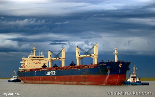
Vessel Clipper Kalavryta IMO: 9663128, MMSI: 538006059 Bulk Carrier
UTC, 6.97167, -82.58667, course: -1, speed: 10
UTC, 6.95167, -82.29833, course: -1, speed: 10
2026-02-13 09:23:41 UTC, 6.91194, -81.97038, course: 96, speed: 10.3
Live AIS position:
UTC. 57 nm SW of Bahía Honda),
updated 2026-02-13 09:23:41 UTC.
Find the position of the vessel Clipper Kalavryta on the map. The latter are known coordinates and path.
marine traffic ship tracker show on live map
The current position of vessel Clipper Kalavryta is 6.91194 lat / -81.97038 lng. Updated: 2026-02-13 09:23:41 UTCDetails:
Last coordinates of the vessel:
UTC, 7.02333, -82.90167, course: -1, speed: 11UTC, 6.97167, -82.58667, course: -1, speed: 10
UTC, 6.95167, -82.29833, course: -1, speed: 10
2026-02-13 09:23:41 UTC, 6.91194, -81.97038, course: 96, speed: 10.3