 vesseltracker.com
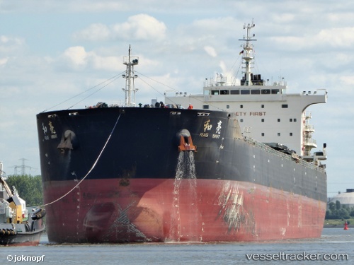
Vessel AGRI BRIGHT IMO: 9663362, MMSI: 538009193 Bulk Carrier
UTC, -6.54500, 148.50333, course: -1, speed: 10
UTC, -6.38903, 148.27849, course: 303, speed: 10.2
2026-02-27 15:13:33 UTC, -6.18647, 147.97758, course: 304, speed: 10
Live AIS position:
UTC. 35 nm N of Tami Island),
updated 2026-02-27 15:13:33 UTC.
Find the position of the vessel AGRI BRIGHT on the map. The latter are known coordinates and path.
marine traffic ship tracker show on live map
The current position of vessel AGRI BRIGHT is -6.18647 lat / 147.97758 lng. Updated: 2026-02-27 15:13:33 UTCCurrently sailing under the flag of Marshall Islands
AGRI BRIGHT built in 2013 year
Deadweight:
74632 tDetails:
Last coordinates of the vessel:
UTC, -6.75333, 148.81332, course: -1, speed: 11UTC, -6.54500, 148.50333, course: -1, speed: 10
UTC, -6.38903, 148.27849, course: 303, speed: 10.2
2026-02-27 15:13:33 UTC, -6.18647, 147.97758, course: 304, speed: 10