 vesseltracker.com
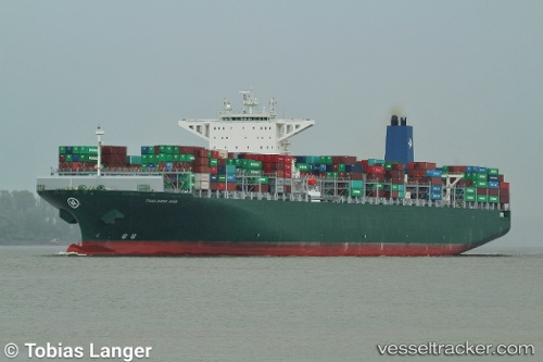
Vessel Thalassa Axia IMO: 9667186, MMSI: 636018701 Container Ship
UTC, 48.21744, -6.36126, course: 220, speed: 9.4
UTC, 47.98054, -6.52984, course: 223, speed: 9.6
2026-02-14 03:34:24 UTC, 47.70305, -6.82585, course: 216, speed: 13.7
Live AIS position:
UTC. 50 nm SE of San Clodio),
updated 2026-02-14 03:34:24 UTC.
Find the position of the vessel Thalassa Axia on the map. The latter are known coordinates and path.
marine traffic ship tracker show on live map
The current position of vessel Thalassa Axia is 47.70305 lat / -6.82585 lng. Updated: 2026-02-14 03:34:24 UTCCurrently sailing under the flag of Liberia
Details:
Last coordinates of the vessel:
UTC, 48.55127, -6.09843, course: 228, speed: 8.8UTC, 48.21744, -6.36126, course: 220, speed: 9.4
UTC, 47.98054, -6.52984, course: 223, speed: 9.6
2026-02-14 03:34:24 UTC, 47.70305, -6.82585, course: 216, speed: 13.7