 vesseltracker.com
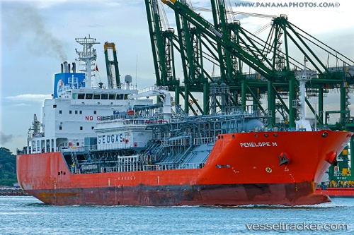
Vessel Penelope M IMO: 9676228, MMSI: 229645000 Lpg Tanker
UTC, 18.30956, -64.94161, course: 115, speed: 0.1
UTC, 18.30937, -64.94172, course: 110, speed: 0.4
2026-01-29 02:23:49 UTC, 18.30960, -64.94152, course: 127, speed: 0.1
Live AIS position:
UTC. Near ST THOMAS),
updated 2026-01-29 02:23:49 UTC.
Find the position of the vessel Penelope M on the map. The latter are known coordinates and path.
marine traffic ship tracker show on live map
The current position of vessel Penelope M is 18.30960 lat / -64.94152 lng. Updated: 2026-01-29 02:23:49 UTCDetails:
Last coordinates of the vessel:
UTC, 18.30950, -64.94165, course: 115, speed: 0.1UTC, 18.30956, -64.94161, course: 115, speed: 0.1
UTC, 18.30937, -64.94172, course: 110, speed: 0.4
2026-01-29 02:23:49 UTC, 18.30960, -64.94152, course: 127, speed: 0.1