 vesseltracker.com
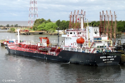
Vessel Maria Emilia Lv IMO: 9680035, MMSI: 701107000 Chemical Oil Products Tanker
UTC, -34.77018, -57.86287, course: 130, speed: 0.1
UTC, -34.77022, -57.86290, course: 130, speed: 0
2026-01-18 15:31:27 UTC, -34.77034, -57.86295, course: 121, speed: 0.1
Live AIS position:
UTC. Near La Plata),
updated 2026-01-18 15:31:27 UTC.
Find the position of the vessel Maria Emilia Lv on the map. The latter are known coordinates and path.
marine traffic ship tracker show on live map
The current position of vessel Maria Emilia Lv is -34.77034 lat / -57.86295 lng. Updated: 2026-01-18 15:31:27 UTCDetails:
Last coordinates of the vessel:
UTC, -34.77002, -57.86268, course: 139, speed: 0.1UTC, -34.77018, -57.86287, course: 130, speed: 0.1
UTC, -34.77022, -57.86290, course: 130, speed: 0
2026-01-18 15:31:27 UTC, -34.77034, -57.86295, course: 121, speed: 0.1