 vesseltracker.com
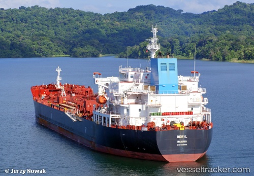
Vessel Beryl IMO: 9681168, MMSI: 538006177 Chemical Oil Products Tanker
UTC, 12.03435, -79.74468, course: 182, speed: 14
UTC, 11.36948, -79.77331, course: 184, speed: 14
2026-02-04 11:40:52 UTC, 11.08117, -79.78764, course: 183, speed: 13.9
Live AIS position:
UTC. 88 nm N of Isla Grande),
updated 2026-02-04 11:40:52 UTC.
Find the position of the vessel Beryl on the map. The latter are known coordinates and path.
marine traffic ship tracker show on live map
The current position of vessel Beryl is 11.08117 lat / -79.78764 lng. Updated: 2026-02-04 11:40:52 UTCCurrently sailing under the flag of Marshall Is
Details:
Last coordinates of the vessel:
UTC, 12.32284, -79.73129, course: 183, speed: 13.9UTC, 12.03435, -79.74468, course: 182, speed: 14
UTC, 11.36948, -79.77331, course: 184, speed: 14
2026-02-04 11:40:52 UTC, 11.08117, -79.78764, course: 183, speed: 13.9