 vesseltracker.com
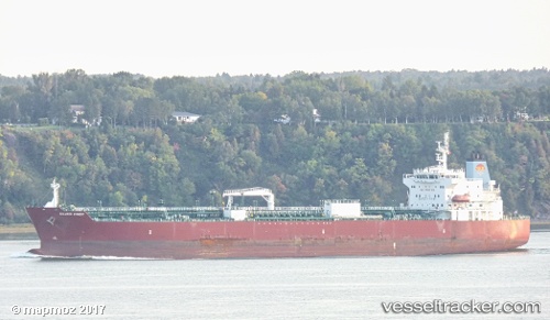
Vessel Silver Cindy IMO: 9682368, MMSI: 538005746 Chemical Oil Products Tanker
UTC, 22.88024, -78.86638, course: 293, speed: 14
UTC, 23.05615, -79.30642, course: 290, speed: 13.2
2026-02-15 21:29:52 UTC, 23.23883, -79.75440, course: 293, speed: 13.1
Live AIS position:
UTC. 22 nm NE of Isabel De Sagua),
updated 2026-02-15 21:29:52 UTC.
Find the position of the vessel Silver Cindy on the map. The latter are known coordinates and path.
marine traffic ship tracker show on live map
The current position of vessel Silver Cindy is 23.23883 lat / -79.75440 lng. Updated: 2026-02-15 21:29:52 UTCDetails:
Last coordinates of the vessel:
UTC, 22.74385, -78.49704, course: 290, speed: 14.1UTC, 22.88024, -78.86638, course: 293, speed: 14
UTC, 23.05615, -79.30642, course: 290, speed: 13.2
2026-02-15 21:29:52 UTC, 23.23883, -79.75440, course: 293, speed: 13.1