 vesseltracker.com
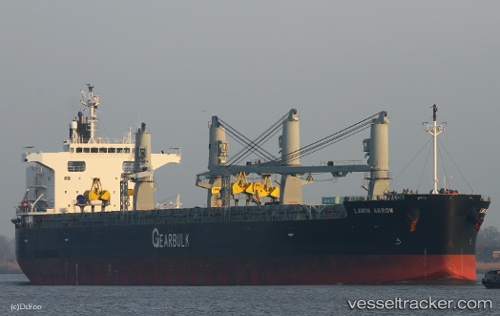
Vessel Lawin Arrow IMO: 9687162, MMSI: 311000235 Bulk Carrier
UTC, 26.81333, -73.97833, course: -1, speed: 13
UTC, 26.74000, -73.87500, course: -1, speed: 12
2026-01-19 18:42:23 UTC, 26.65167, -73.74833, course: -1, speed: 12
Live AIS position:
UTC. 161 nm NE of Arthur's Town, Cat Island),
updated 2026-01-19 18:42:23 UTC.
Find the position of the vessel Lawin Arrow on the map. The latter are known coordinates and path.
marine traffic ship tracker show on live map
The current position of vessel Lawin Arrow is 26.65167 lat / -73.74833 lng. Updated: 2026-01-19 18:42:23 UTCDetails:
Last coordinates of the vessel:
UTC, 27.10573, -74.37061, course: 128, speed: 13.7UTC, 26.81333, -73.97833, course: -1, speed: 13
UTC, 26.74000, -73.87500, course: -1, speed: 12
2026-01-19 18:42:23 UTC, 26.65167, -73.74833, course: -1, speed: 12