 vesseltracker.com
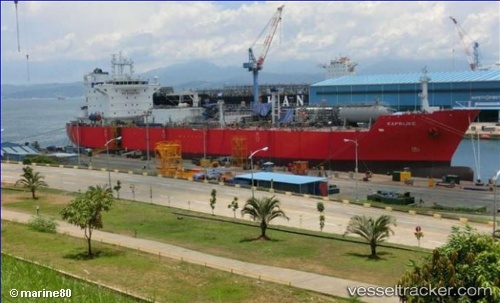
Vessel Kaprijke IMO: 9687485, MMSI: 205283000 Lpg Tanker
UTC, -12.84058, -138.02972, course: 277, speed: 15.5
UTC, -12.80833, -138.31667, course: -1, speed: 15
2026-02-21 09:28:59 UTC, -12.74667, -138.85834, course: -1, speed: 15
Live AIS position:
UTC. 124 nm N of Pukapuka),
updated 2026-02-21 09:28:59 UTC.
Find the position of the vessel Kaprijke on the map. The latter are known coordinates and path.
marine traffic ship tracker show on live map
The current position of vessel Kaprijke is -12.74667 lat / -138.85834 lng. Updated: 2026-02-21 09:28:59 UTCDetails:
Last coordinates of the vessel:
UTC, -12.92167, -137.30833, course: -1, speed: 16UTC, -12.84058, -138.02972, course: 277, speed: 15.5
UTC, -12.80833, -138.31667, course: -1, speed: 15
2026-02-21 09:28:59 UTC, -12.74667, -138.85834, course: -1, speed: 15