 vesseltracker.com
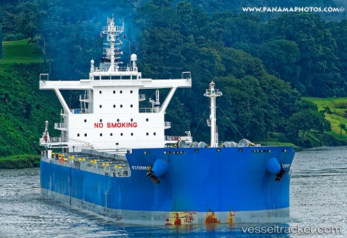
Vessel MARINA I IMO: 9687837, MMSI: 538009110 Bulk Carrier
UTC, -11.40500, -24.61333, course: -1, speed: 11
UTC, -11.62500, -24.31667, course: -1, speed: 11
2026-03-06 14:17:07 UTC, -11.91167, -23.93667, course: -1, speed: 11
Live Vessel MARINA I Analytics (details, animations, etc.)
Live AIS position: UTC. Open sea (no nearby ports in database)), updated 2026-03-06 14:17:07 UTC.Find the position of the vessel MARINA I on the map. The latter are known coordinates and path.
marine traffic ship tracker show on live map
The current position of vessel MARINA I is -11.91167 lat / -23.93667 lng. Updated: 2026-03-06 14:17:07 UTCCurrently sailing under the flag of Marshall Islands
MARINA I built in 2015 year
Deadweight:
81014 tDetails:
Last coordinates of the vessel:
UTC, -11.15833, -24.92333, course: -1, speed: 11UTC, -11.40500, -24.61333, course: -1, speed: 11
UTC, -11.62500, -24.31667, course: -1, speed: 11
2026-03-06 14:17:07 UTC, -11.91167, -23.93667, course: -1, speed: 11