 vesseltracker.com
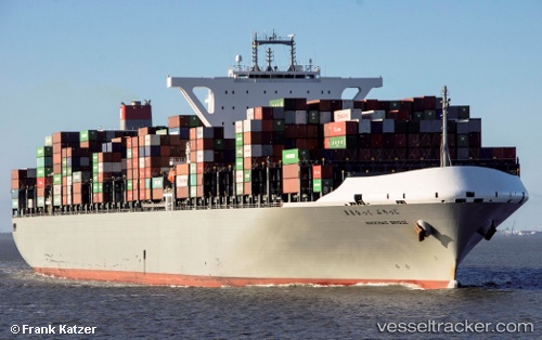
Vessel Mackinac Bridge IMO: 9689603, MMSI: 431241000 Container Ship
UTC, 17.78582, -28.61352, course: 322, speed: 17
UTC, 18.28116, -29.04953, course: 322, speed: 17.4
2026-02-22 01:24:00 UTC, 18.57609, -29.30291, course: 322, speed: 17.5
Live AIS position:
UTC. 266 nm NW of Porto Grande),
updated 2026-02-22 01:24:00 UTC.
Find the position of the vessel Mackinac Bridge on the map. The latter are known coordinates and path.
marine traffic ship tracker show on live map
The current position of vessel Mackinac Bridge is 18.57609 lat / -29.30291 lng. Updated: 2026-02-22 01:24:00 UTCCurrently sailing under the flag of Japan
Details:
Last coordinates of the vessel:
UTC, 17.39645, -28.28286, course: 325, speed: 16.7UTC, 17.78582, -28.61352, course: 322, speed: 17
UTC, 18.28116, -29.04953, course: 322, speed: 17.4
2026-02-22 01:24:00 UTC, 18.57609, -29.30291, course: 322, speed: 17.5