 vesseltracker.com
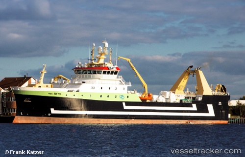
Vessel Mark IMO: 9690688, MMSI: 218799000 Fishing Vessel
UTC, 65.5806, -29.2348, course: 286, speed: 7.9
UTC, 65.7329, -29.8391, course: 359, speed: 7.9
2026-03-05 00:13:03 UTC, 65.6973, -29.8792, course: 206, speed: 3
Live Vessel Mark Analytics (details, animations, etc.)
Live AIS position: UTC. 145 nm W of PATREKSFJORDUR), updated 2026-03-05 00:13:03 UTC.Find the position of the vessel Mark on the map. The latter are known coordinates and path.
marine traffic ship tracker show on live map
The current position of vessel Mark is 65.6973 lat / -29.8792 lng. Updated: 2026-03-05 00:13:03 UTCDetails:
Last coordinates of the vessel:
UTC, 65.5806, -29.2348, course: 286, speed: 7.9UTC, 65.5806, -29.2348, course: 286, speed: 7.9
UTC, 65.7329, -29.8391, course: 359, speed: 7.9
2026-03-05 00:13:03 UTC, 65.6973, -29.8792, course: 206, speed: 3