 vesseltracker.com
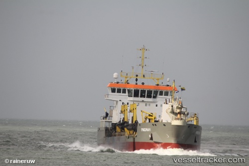
Vessel Freeway IMO: 9691682, MMSI: 212368000 Hopper Dredger
UTC, 52.03672, 4.04718, course: 224, speed: 13.2
UTC, 51.99793, 4.01968, course: 193, speed: 2.4
2026-02-06 01:42:55 UTC, 51.99208, 4.03965, course: 186, speed: 2.7
Live AIS position:
UTC. Near Haarlemmermeer),
updated 2026-02-06 01:42:55 UTC.
Find the position of the vessel Freeway on the map. The latter are known coordinates and path.
marine traffic ship tracker show on live map
The current position of vessel Freeway is 51.99208 lat / 4.03965 lng. Updated: 2026-02-06 01:42:55 UTCCurrently sailing under the flag of Cyprus
Details:
Last coordinates of the vessel:
UTC, 52.05638, 4.08701, course: 42, speed: 8.9UTC, 52.03672, 4.04718, course: 224, speed: 13.2
UTC, 51.99793, 4.01968, course: 193, speed: 2.4
2026-02-06 01:42:55 UTC, 51.99208, 4.03965, course: 186, speed: 2.7