 vesseltracker.com
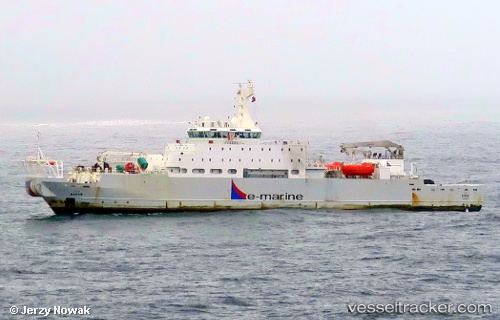
Vessel Maram IMO: 9692442, MMSI: 470295000 Cable Layer
UTC, 28.86833, 32.87500, course: -1, speed: 0
UTC, 28.86795, 32.87347, course: -1, speed: 0
2026-03-02 05:31:47 UTC, 28.86747, 32.87603, course: 2, speed: 0.5
Live AIS position:
UTC. 13 nm W of Ras Budran),
updated 2026-03-02 05:31:47 UTC.
Find the position of the vessel Maram on the map. The latter are known coordinates and path.
marine traffic ship tracker show on live map
The current position of vessel Maram is 28.86747 lat / 32.87603 lng. Updated: 2026-03-02 05:31:47 UTCDetails:
Last coordinates of the vessel:
UTC, 28.86838, 32.87807, course: 2, speed: 0UTC, 28.86833, 32.87500, course: -1, speed: 0
UTC, 28.86795, 32.87347, course: -1, speed: 0
2026-03-02 05:31:47 UTC, 28.86747, 32.87603, course: 2, speed: 0.5