 vesseltracker.com
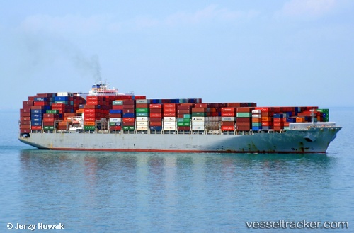
Vessel Symi I IMO: 9695028, MMSI: 636016306 Container Ship
UTC, 14.69715, -66.91046, course: 250, speed: 11.9
UTC, 14.56321, -67.29802, course: 249, speed: 11.9
2026-03-05 03:36:53 UTC, 14.41378, -67.73369, course: 247, speed: 12.3
Live Vessel Symi I Analytics (details, animations, etc.)
Live AIS position: UTC. 136 nm N of Dorp Rincón), updated 2026-03-05 03:36:53 UTC.Find the position of the vessel Symi I on the map. The latter are known coordinates and path.
marine traffic ship tracker show on live map
The current position of vessel Symi I is 14.41378 lat / -67.73369 lng. Updated: 2026-03-05 03:36:53 UTCCurrently sailing under the flag of Liberia
Symi I built in 2014 year
Deadweight:
111700 tDetails:
Last coordinates of the vessel:
UTC, 14.82752, -66.58917, course: 248, speed: 12.3UTC, 14.69715, -66.91046, course: 250, speed: 11.9
UTC, 14.56321, -67.29802, course: 249, speed: 11.9
2026-03-05 03:36:53 UTC, 14.41378, -67.73369, course: 247, speed: 12.3