 vesseltracker.com
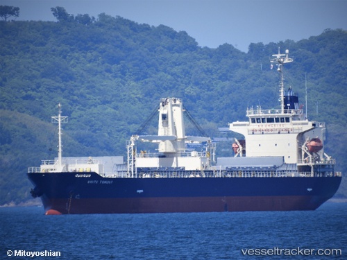
Vessel White Tomony IMO: 9695810, MMSI: 548979000 General Cargo Ship
UTC, 37.95019, 139.07246, course: 95, speed: 0
UTC, 37.95021, 139.07249, course: 95, speed: 0
2026-02-19 14:22:20 UTC, 37.95020, 139.07249, course: 95, speed: 0
Live AIS position:
UTC. Near Niigata),
updated 2026-02-19 14:22:20 UTC.
Find the position of the vessel White Tomony on the map. The latter are known coordinates and path.
marine traffic ship tracker show on live map
The current position of vessel White Tomony is 37.95020 lat / 139.07249 lng. Updated: 2026-02-19 14:22:20 UTCDetails:
Last coordinates of the vessel:
UTC, 37.95017, 139.07246, course: 95, speed: 0UTC, 37.95019, 139.07246, course: 95, speed: 0
UTC, 37.95021, 139.07249, course: 95, speed: 0
2026-02-19 14:22:20 UTC, 37.95020, 139.07249, course: 95, speed: 0