 vesseltracker.com
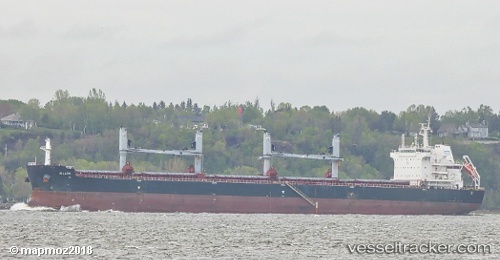
Vessel Iolaos IMO: 9696450, MMSI: 636017197 Bulk Carrier
UTC, 11.25232, -74.21527, course: 335, speed: 0
UTC, 11.25234, -74.21532, course: 335, speed: 0
2026-02-20 17:56:28 UTC, 11.25231, -74.21526, course: 335, speed: 0
Live AIS position:
UTC. Near Santa Marta),
updated 2026-02-20 17:56:28 UTC.
Find the position of the vessel Iolaos on the map. The latter are known coordinates and path.
marine traffic ship tracker show on live map
The current position of vessel Iolaos is 11.25231 lat / -74.21526 lng. Updated: 2026-02-20 17:56:28 UTCDetails:
Last coordinates of the vessel:
UTC, 11.25232, -74.21528, course: 335, speed: 0UTC, 11.25232, -74.21527, course: 335, speed: 0
UTC, 11.25234, -74.21532, course: 335, speed: 0
2026-02-20 17:56:28 UTC, 11.25231, -74.21526, course: 335, speed: 0